

Tramping the Dunes
Blyth Beach, or more properly South Beach, is a 4 Kilometres long sandy bay between the harbours of Blyth and Seaton Sluice in Southeast Northumberland. It is a beautiful, easily accessed stretch of golden sand, backed by grass covered dunes. On a sunny day it’s a family destination for picnics, if there’s a surf running the good car parking attracts surfers and all year round there are dog walkers, cyclists and runners exercising up and down the paths through the dunes and on the beaches. For the people who know it, it’s a place of contrasts, an ever-changing natural landscape set against the industrial background of the working port.

However, if you dig a bit deeper there’s a story to be told about the deep origins of the area told in the various geological layers to be seen here. From the rocks protecting the harbours, to the traces of coal on the beach which bear witness to the industrial history of the area. The boulders on the beach and the clay level seen below the dune sand remind us of the great ice age that swept the area tens of thousands of years ago. Parts of the dune system has perhaps been there as long as humans have walked over the area.
Tramping up and down the beach over the years it’s become clear that these three successive geological layers can be found on the beach, although sometimes the older lower ones can be covered by the most recent moving beach sands. We’ll look at them one by one, starting with the oldest.
The Rocky Carboniferous
Geology is the study of the Earth’s past. It’s a long past, from the origins of the earth about 4.55 billion years (4,550,000,000) ago to today. That’s a long time and the further you go back the harder it is to find evidence of what happened. To interpret it you need some understanding of how the world works, so here goes!

The world is a ball of rock hurtling through space and orbiting around the sun. It has a core of iron and above that a layer of molten rock called the mantle. The thin outer layer is the crust which is solid. However, due to unequal heating in the mantle the crust is cracked and the pieces of the crust, known as the plates, are pushed around the globe. They don’t move very fast, about 10 – 40 mm a year (about as fast as a fingernail grows) Over the past several millions of years the ground we stand on at Blyth beach has moved thousands of miles all over the Earth’s surface. Now it sits at a latitude of 55 degrees North in the northern temperate region.
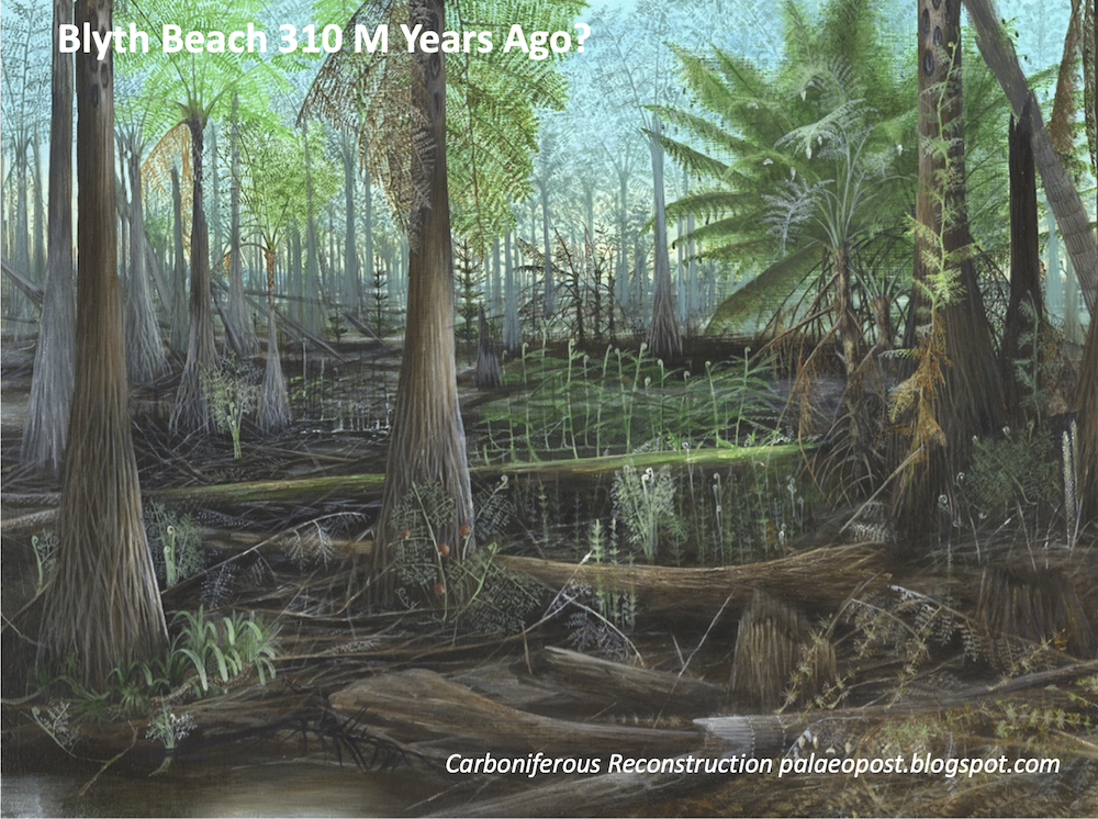
About 310 million years ago (310,000,000), during the time known as the Westphalian Stage of the Late Carboniferous Period, Blyth probably lay more or less on the equator. It was very different from today, a swampy land of giant tree ferns cut through by wide rivers. Over time the forests were buried and warmed and transformed to coal, the swampy clays hardened to shale and the sands of the rivers hardened to sandstone. Blyth is built on these rocks; they are below us all. These coals were mined and shipped from Blyth in the past and helped transform Blyth from a sleepy riverside village into one of the biggest coal exporting ports in the world at one time.
Scattered over the beach you’ll also find small flakes of coal, torn up from coal seams below the waves or reworked from the coal mining waste dumped into the sea in. People used to collect this ‘sea coal’ to sell at some places along the coast.

If you stand on Blyth beach, you’ll find boulders and pebbles of the hard river sandstone. You’ll also see the rocky headlands of Seaton Sluice and Blyth formed by these sandstones. Today, these reefs provide shelter from the waves and form the natural protection of the harbour. Sadly, they also wrecked many boats driven onto the rocks by storms as they tried to reach the safety of the harbour.

If you want to have a better look at these rocks go to Seaton Sluice. Here the river sands can be clearly seen.

The Big Freeze
Over the next 310 million years the piece of land that is now Blyth beach moved steadily northwards across the surface of the globe. During this enormously long period of time 2 – 3 Kilometres of rock was laid down over the area and then removed by cataclysmic earth tearing forces. However, from our standpoint on the beach, we can’t see any of the evidence for this. It’s only by studying the rest of the country, in fact the rest of the world, that we can piece together what happened.
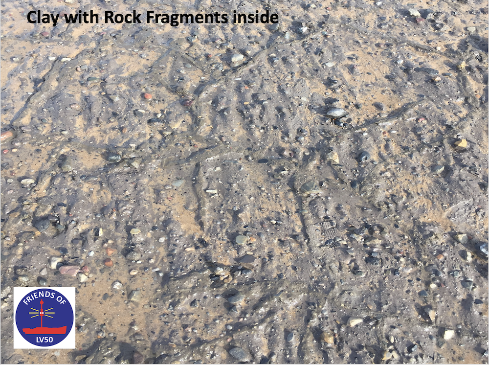
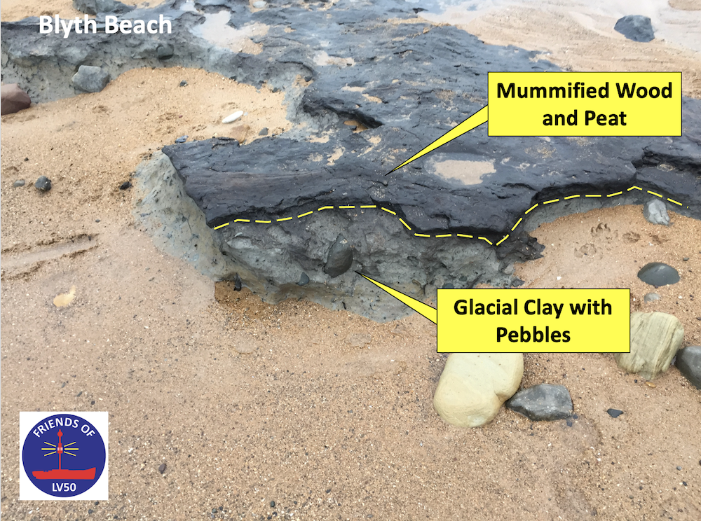
The next layer of the beach is the most difficult to find. It’s often hidden under the shifting sands. When it is visible, it’s not very impressive, it consists of 20 – 30 cm of grey-brown sticky clay with lots of fragments of different types of rock in it. On top of it is a layer of pebbles and boulders which is easier to see. These were once encased in clay as well but have been washed out by the sea. This layer can be traced under the town in numerous excavations that have been made before houses were built. It is usually 2 – 4 m thick but can be as thick as 7m. What we see on the beach is just the thin edge of a wedge of clay, the rest of it having been washed away by the sea.

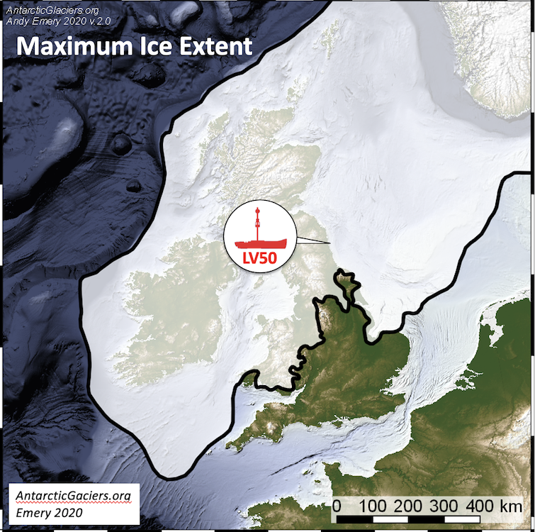
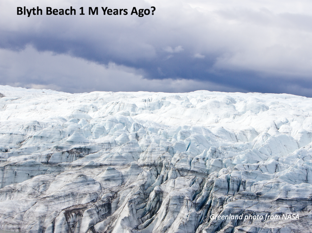
What is it? If you’d been standing on the beach 30 thousand years ago (30,000) you’d have been in a very different landscape. A frozen landscape with several hundred metres of ice all over the area. Beneath you would have been a massive glacier slowly moving eastwards and southwards. As the ice moved it plucked up rocks and scraped and grated away the soil, grinding down to the bare rock. Some of these boulders came from Scotland and Scandinavia, carried by the moving ice. When the ice melted, it left behind a layer of clay, from the ground down rocks, and boulders and pebbles carried along by the glaciers. Together they form this clay rich layer that covers most of the northern part of England. The clay layer is difficult to see and it is best exposed after stormy seas have stripped off the beach sand.

The Big Melt and Afterwards.
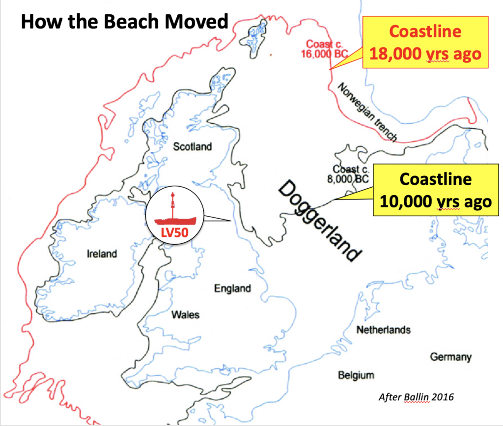
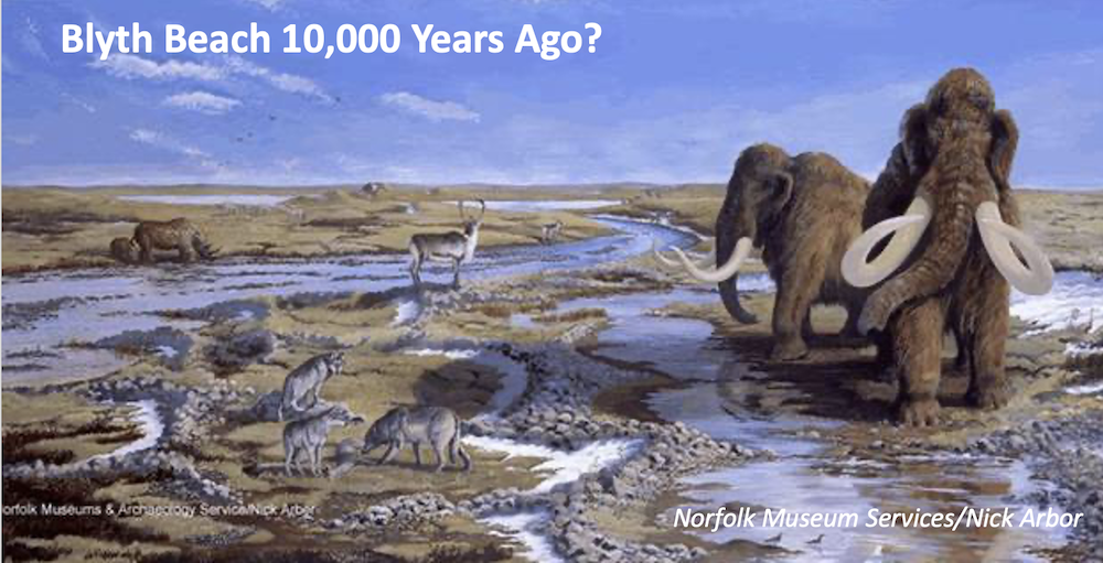
When the ice melted across this area, about 18 thousand years ago, Blyth would still have been a frozen tundra with migrating herds of Reindeer and even Mammoths. The biggest surprise however would have been that the North Sea wasn’t there. So much water was tied up in the Kilometres of ice that the sea-level had been lowered by more than 50m and the coastline far was away over the horizon, nearly at Norway. Over the next 6,000 years, as the glaciers melted, the sea returned. By about 10,000 years ago, it would have been close to where it is now.
The mummified forest
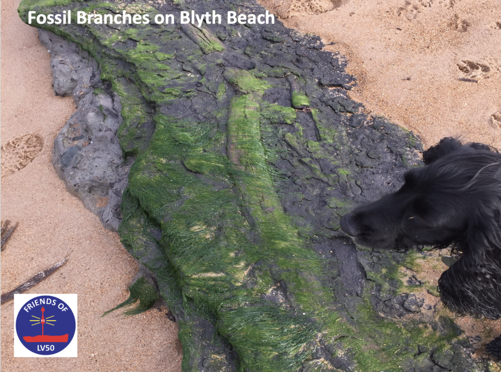
Sometimes on the beach, mainly at the Seaton Sluice end, you can see the remains of a mummified forest that rests on the glacial clay. Branches and sometimes tree trunks can be seen encased in a layer of peat.
The base of the peat is an old land surface that has preserved, in some places, the traces of the first humans to walk the area. The surface is about 10,000 years old and Mesolithic age worked flint flakes, traces of people who lived here then, have been found in the area. Little is known of the people, they were probably ‘hunter-gathers’ who moved through the area opportunistically gathering food as they went. They probably did not live here all year round as it was still too cold in winter. The landscape would have been covered in trees that we know today, such as elder, oak, alder and birch.
This surface and peat layer are much better seen on the shore to the North, between Amble and Hauxley. There are several layers of peat, of different ages here that have been dated to between 6,000 and 2,500 years ago.

Human remains have been found associated with these Neolithic and Bronze Age peats. These would have been people transitioning from a ‘hunter-gather’ lifestyle to more settled way of life, raising animals and growing crops. They probably did this in a number of stages. Firstly, cutting down the trees, maybe burning them, to let more light reach the forest floor to encourage plant growth to feed the wild animal. Later, cutting or burning more trees to grow crops in small fields for a few years before moving on. Finally, settling more permanently in the area, planting and growing crops and raising animals for food.
The Dunes
One of the features of Blyth beach, and much of the Northumberland coast, are the sand dunes. These are a line of old sand dunes, now covered in grass and other plants, blown there by the wind in the past.

But when? They are made of sand that looks very much like the beach sand of today so how did they get there? The dominant wind direction now is from the West which would have blown the beach sand back out to sea. So sometime in the past it must have been from the East, blowing the sand inland. Some studies have been done to work out how old the dunes of Alnmouth, Amble and Druridge Bay are but such studies have not yet been done on Blyth. This work shows that the lower part of the dunes might be as old 3,000 years but most of the sand was blown there in the last 1,000 years. This corresponds to the Little Ice Age, a period when there were some unusually cold years. Climate modelling indicates these cold periods might have been associated with a dominant easterly wind. This could have formed the dunes.
The Beach
Between the dunes and the sea is the beach. A thin ribbon of sand at high tide but a flat expanse when the tide is low. Anyone regularly visiting will know that it is an ever-changing landscape. Sand piles up and then it is washed away to show the boulders below, the beach is never the same.

The beach is not a flat slope dipping steadily towards the sea. There is a steeper sloping beach face (or shoreface) made of sand pushed up the slope (and washed away) by the waves at high tide. Then there is the beach flat with its crescent shaped bodies of sand being pulled up the beach by the waves as the tide comes in.


Winter storms can strip the beach bare of sand while the gentler waves of summer slide the sand back up. The sand level on the beach can easily change by 1.5m in a month. The sand doesn’t just move in and out. The waves, crashing onto the beach at an angle, push the sand along the beach. This is called ‘longshore drift’. The tidal currents also move the sand along sideways but a bit further offshore than the beach.
Today
Blyth today is a vibrant coastal town. This is largely thanks to the coal that was extracted from the area and shipped out of the port but that’s another story.
The future
We’ve seen the evidence of dramatic changes to Blyth beach. From the tropical forest of the Late Carboniferous 310 million years ago to the Ice Age 1 million years ago. What about the future? Could it be equally dramatic?
Blyth owes its existence to coal, a fossil fuel. Although coal is no longer mined here its presence is all around us. The coal was burnt to provide heat to drive the furnaces of the industrial revolution and to heat homes. Much of the carbon dioxide generated is still in the atmosphere contributing to global climate change. How might this change Blyth? Nobody knows for certain, but some climate change models predict sea-level rises of over 1 metre by the end of the 21st centaury.
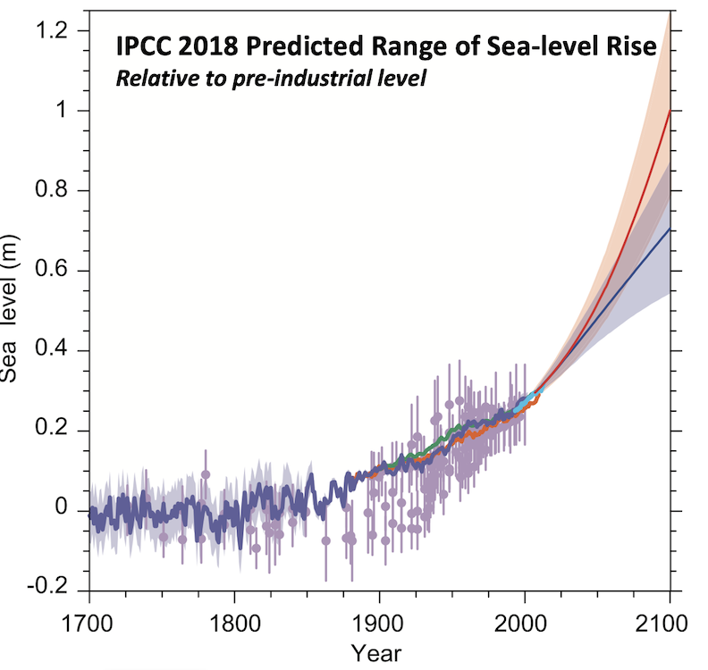
However, if over the next several thousands of years all the ice caps of Greenland melt sea-level rise would be much more than this, perhaps 4 to 8 m? As much as half of Blyth could be under-water at high tide then. The top of the Isabelle Heap (an old coal pit heap and the highest point in Blyth) is about 30m above sea-level.

If all the Antarctic ice melts sea-level rise could be nearly 60m. In which case in the far future, Blyth would be gone and half of Cramlington as well. If all the ice melts the sea-level could rise by as much as 85m?
Pebbles on the beach

Like the history of Blyth, the stones on the beach each tell a story. That is if you know how to read them, what they are made of, where they came from and how they got on the beach. With more knowledge you can reconstruct 300 million years of history of Blyth beach.